Activities in Nile Valley

Things to Do

Dababiya National Park Egypt

Dababiya National Park

  • Dababiya National Park Egypt
  • Dababiya National Park Egypt
  • Dababiya National Park Egypt
  • Dababiya National Park Egypt
  • Dababiya National Park Egypt
  • Dababiya National Park Egypt
  • Dababiya National Park Egypt

Dababiya National Park Egypt information, tours, prices and online booking

Dababiya National Park is a protected area located in the Luxor Governorate near to Esna temple. Moreover, it is by the sedimentary sequence of the Eastern Desert mountains. In fact, Dababiya National Park has an estimated age of 50–55 million years old. Moreover, the protected area considered to show an ideal geological sequence. In fact, the geological sequence represents a time scale considered to the most perfect strata in the world. The strata represent a history of the beginnings of modern fauna and flora. This precious section of the protected area allowed geologist estimate the age of the earth. In fact, it is by identifying the marine sediments and determining the processes that coincided with their deposition and the creatures that contributed to each stratum.

Nearby attractions Information, tours and Online Booking

More of Egypt Nature Exploration

More of Egypt’s attractions

MORE
Zoser Step Pyramid Cairo

Zoser Step Pyramid Cairo

  • Zoser Step Pyramid Cairo
  • Zoser Step Pyramid Cairo
  • Zoser Step Pyramid Cairo
  • Zoser Step Pyramid Cairo
  • Zoser Step Pyramid Cairo
  • Zoser Step Pyramid Cairo

Zoser Step Pyramid Cairo Egypt tours, prices, booking, reviews

Zoser Step pyramid Cairo located at Sakkara necropolis. The pyramid also known as Djoser Pyramid. In fact, Zoser is the common name of Djoser or Netjerykhet. Sakkara is about 40 kilometer south of Cairo. Zoser Step pyramid Cairo constructed 470 years ago. Moreover, it is the first pyramid which built by ancient Egyptians. Zoser or Djoser was a king of Egypt’s third dynasty. The planning of the pyramid attributed to Imhotep. Furthermore, Imhotep was a vizier (minister) and he deified for his accomplishments. In fact, the step pyramid started off as a Mastaba tomb. Mastaba is a flat roofed structure with sloping sides. The pyramid is a series of expansions. They evolved into a 197-foot-high (60 meters) with six layers. One built on top of the other.

Moreover, Zoser Step pyramid Cairo constructed using 11.6 million cubic feet of stone and clay. The tunnels beneath the pyramid form a labyrinth about 3.5 miles (5.5 kilometers) long. In addition, the step pyramid is at the center of a complex. This complex is about 37 acres (15 hectares) in size. Furthermore, the complex surrounded by a recessed limestone wall. The wall contains 13 fake doorways. It is besides the real colonnade entrance on the southeast side. Additionally, a temple lies on the north side of the step pyramid along with a statue of the king. The statue surrounded by a small stone structure. It known as a Serdab. The statue eyes peeking out through a hole. To the south of the pyramid lies a great court. Furthermore, the court has an altar and stones identified as boundary markers.

Further details about Zoser Step Pyramid Cairo (Djoser Pyramid):

In fact, many of facade (dummy) buildings constructed in the complex. They include a series of chapels. The chapels are also in the southeast. It is in addition to and south pavilions on the east side of Zoser Step pyramid Cairo. These structures served ritual purposes. Moreover, they appear to partly buried by their builders. It noted also by Egyptologist Mark Lehner in his book “The Complete Pyramids”. Furthermore, there is also a court in the southeast side of the complex. It is next to the dummy chapels. In fact, this court allows the king to enact the Heb-Sed jubilee festival. It is presumably in the afterlife. At the southern end of the complex lies the enigmatic “south tomb” with a chapel. It also contains a series of tunnels that mimic those found beneath the pyramid itself. In fact, what buried there is a mystery.

King’s burial chamber of Zoser Step Pyramid Cairo (Djoser Pyramid):

Beneath the pyramid Cairo is a bewildering array of tunnels and chambers. The center is 28 meters deep. It also contains the burial chamber of king Djoser at its bottom. There was recent conservation work in the burial chamber. It reveals fragments of the king’s granite sarcophagus. The names of queens still legible. Moreover, eleven of the king’s daughters buried inside Zoser Step Pyramid. This what said by Egyptologist Zahi Hawass in 2009 video. Dr. Zahi is the former minister of state for antiquities. The vault decorated with limestone blocks containing five pointed stars. They creating a star filled ceiling. This decoration scrapped by its builders in favor of a simpler granite burial chamber. It also was for reasons unknown,

Tunnels and underground palace of Zoser Step Pyramid Cairo:

Two passages lead underground and branch off in three directions. They contain three magazine galleries and a special tunnel for food offerings. They also include an uncompleted chamber. However, this chamber maybe acted as an underground “palace” for the afterlife. There are also three false doors contain Stele. They show the king engaged in rituals. Moreover, the chamber decorated with thousands of blue faience tiles. They also imitate the reed matting found in the king’s real life palace in Memphis. This chamber beneath the pyramid hastily completed. Yet another tunnel, starting on the east side of the pyramid. It contains 40,000 stone vessels. Many of them belong to the king’s ancestors. Sarcophagi and human remains also found.

Modern day conservation of Zoser Step Pyramid Cairo (Djoser Pyramid):

In fact, the step pyramid is in a fragile state. Furthermore, without conservation work, the tunnels beneath the pyramid could collapse. It also said that the pyramid maybe goes in couple of decades. An Egyptian conservation effort began several years ago. CINTEC is a British engineering company. It called in to aid with efforts. They used giant airbags to hold up the pyramid’s roof. It is while permanent repairs to the structure of the pyramid carried out.

Zoser Step pyramid Cairo construction would see the beginning of an ambitious pyramid building program. Moreover, it would culminate with the Great Pyramids at Giza. In fact, Imhotep regarded as a sort of god. King Djoser (Netjerykhet) gave Imhotep a rare honor. Furthermore, he allowed his name and titles to carve on the base of one the king’s statues. It is what written by Marc Van in his book “A History of Ancient Egypt”. One of his titles is “chief of sculptors”. It is a phrase fitting for someone who designed the first Egyptian pyramid.

Nearby attractions Information, tours and Online Booking

More of Ancient Egypt

More of Egypt attractions

MORE
Wadi El Allaqi Aswan

Wadi El Allaqi Aswan

  • Wadi El Allaqi Aswan
  • Wadi El Allaqi Aswan
  • Wadi El Allaqi Aswan
  • Wadi El Allaqi Aswan
  • Wadi El Allaqi Aswan
  • Wadi El Allaqi Aswan

Wadi El Allaqi Aswan Egypt tours, prices, booking, reviews

Wadi El Allaqi Aswan located 180 Km southeast of Aswan, Egypt. The area of Wadi El Allaqi Aswan declared as a protectorate in 1989. In fact, the site area is about 30000 square kilometer. The area is a large dry river which used to rise from the Red Sea hills especially Elba mountain. After the construction of the High Dam in Aswan, the water flowed and collected into the site. And then, it became the lakes’ part. The protectorate is a valley which is a result of the drying of a large river. In fact, it is 1 km wide and 275 km long. In fact, the valley features more than 90 species of plants. They are from the annual and perennial categories. Moreover, it also has over 15 species of mammals and 16 species of birds.

Wadi El Allaqi Aswan also has some venom containing reptiles and a large variety of invertebrates. The Wadi has greenery and rich soil acting as a pasture for animals. The astounding botanical variety which found here is no less than a treat for nature lovers. Wadi Allaqi Aswan bounded by Nasser’s Lake to the west and Red Sea by the east. The region of the valley has the earliest reference to mining which took place here. The mining took place during the Twelfth Dynasty of the Middle Kingdom. It was when the region known by the name Akita which located in the Land of the Wawat. In 1900s the area mined by British and South Africa companies as well.

Further details about Wadi El Allaqi Aswan:

The historical mining focused on the mining of high grade quartz veins and alluvial gold. The stooped out quartz veins show the historical mining activity. Waste dumps and tailing also seen in many deposits. They show that the site saw significant mining activities in the past. In fact Wadi El Allaqi Aswan also used by the nomadic tribes Bejas who live in the area. In fact, around 1000 members of Bisharyn and Ababda live here. The tribes used this land to graze livestock, for producing charcoal for fuel. They also did to collect medicinal plants. Also quarrying of nickel and copper and agriculture on a small scale done here. Some variety of medicinal plants also collected from the area.

In fact, all such activities somehow stopped from the Wadi in 1989. It was after it declared as a nature reserve. Since then, it managed by the Egyptian Environmental Affairs Agency. In 1993, it also declared as a biosphere Reserve by the UNESCO. Wadi El Allaqi Aswan area made up of nine tenement areas. Eight contain historical gold workings. The ninth one is a rich reserve of copper-nickel deposits. There are in total nine prospects, each of which covers 16 km 2 in area.

Nearby attractions Information, tours and Online Booking

More of Egypt Nature Exploration

More of Egypt attractions

MORE
Wadi El Natrun Egypt

Wadi El Natrun Egypt

  • Wadi El Natrun Egypt
  • Wadi El Natrun Egypt
  • Wadi El Natrun Egypt
  • Wadi El Natrun Egypt
  • Wadi El Natrun Egypt
  • Wadi El Natrun Egypt

Wadi El Natrun Egypt information, tours, prices, booking

Wadi El Natrun Egypt is a northwest oriented desert depression. Moreover, Wadi El Natrun located about 60 km in the Western Desert near the delta. The site lies some 23 m below sea level. The lakes fed from the water table of the Nile dot the landscape. The valley also known as area for bird watching. Furthermore, the site contains a series of nine small lakes. Its total area 200 km, scattered along its general axis. Juncus and Cyperus dominate the wet salt marshes on the waterlogged eastern shores. This creates one of the most characteristic and attractive habitats for water birds.

The history of the Wadi El Natrun Egypt and its importance to Coptic Christians, dates back to the 4th century AC. Christianity reached the area with St. Macarius the Great who retreated there in 330 AC. At that time, the monastic life not yet developed. During this period, holy men were hermits, living outside social structures. The reputation of St. Macarius attracted followers and they built cells nearby. They began a loose confederation of monastic communities. Many of these early settlers from Nitria, followed the Christian hermit lifestyle. Hence, Scetis was less a place of innovation than a locus of consolidation.

Further details about Wadi El Natrun Egypt:

In fact, monasticism developed a form of semi anchoritism there. Moreover, hermits lived in cells or caves comprising two or more rooms, one of which functioned as an oratory. A new monk apprenticed himself to an experienced desert father and became his disciple. Monks earned their living by plying crafts, especially basketry and rope making. On Saturday and Sunday the monks go to the church to celebrate Mass. Sometimes they take a Sunday meal in common. In end of the fourth century the of Christian settlers became four monastic communities. They were the monasteries of (old) Baramus, Macarius, Bishoi and John the Little.

Furthermore, the monasteries were collections of individual cells and dwellings which centered on specific churches. They developed into enclosures with walls and watchtowers for protection. That was because, like Nitria and Kellia, Scetis was at times subject to raids from desert nomads. The nomads of the Libyan desert sacked and destroyed the monasteries of Wadi El Naturn in 407, 434 and 444. Indeed, raids at the end of the sixth century almost depopulated the area. The monks built towers to live in. In the ninth century, they erected walls to fortify their monasteries. Many of monks were living outside the walls of the enclosed monasteries. Later on, the monks began to leave their scattered cells to live in the fortified monasteries.

More details about Wadi El Natrun Egypt:

In fact, in the fourteenth century, monastic life became more cenobitic. That was because the monks went to the enclosure walls for protection. The plague decimated many residents in the monastery during the Middle Ages. The organizations of monks grew up and forced to be together by common needs. Each of the monasteries had a council. One of the council’s responsibilities was to communicate with the external world. The council was also responsible for keeping the general discipline in the monastery. Because of a poll tax on the monks from 705 onward, monasticism began to decline.

Nowadays, four active Monasteries remain at Wadi El Natrun. They are Baramous monastery, St. Bishoi Monastery, St. Makarius monastery and Suryan monastery. The monasteries welcome visitors, irregardless of their faith. The monks are in general friendly. Usually, most of the areas within the monasteries can visited. There is no problem taking photographs most anywhere, including inside the ancient churches. Wadi Naturn is a quick, easy journey from Cairo.

Nearby attractions Information, tours and Online Booking

More of Egypt Nature Exploration

More of Egypt attractions

MORE
Valley of the Kings Luxor

Valley of the Kings Luxor

  • Valley of the Kings Luxor
  • Valley of the Kings Luxor
  • Valley of the Kings Luxor
  • Valley of the Kings Luxor
  • Valley of the Kings Luxor
  • Valley of the Kings Luxor
  • Valley of the Kings Luxor

Valley of the Kings Luxor Egypt tours, prices, booking, reviews

Valley of the Kings Luxor necropolis located in the west bank in Luxor, Egypt. In fact, the valley of the Kings Luxor is an area for tombs. The tombs built for the Pharaohs and powerful nobles of the New Kingdom of Ancient Egypt. In fact the Ancient Egypt religion based on the cult of death. It also based on the lifelong preparation for the afterlife. The valley in the West Bank necropolis is a mute testimony to this obsession. The pharaohs buried in secret tombs here and protected by the best security of the age. Few burial sites escaped the plundering of grave robbers.

The Valley of the Kings Luxor created and used from 1539 BC to 1075 BC. It contains about 60 tombs, starting with Thutmose I and ending with Ramses X or XI. The official name of the site was The Great and Majestic Necropolis of the Millions of Years of the Pharaoh. The valley also had tombs for the favorite nobles and the wives. It also had children of both the nobles and pharaohs. Around the time of Ramses I 1300 BC, they start to build the Valley of the Queens. In fact some wives still buried with their husbands at the Valley of Kings Luxor.

What to See at the Valley of the Kings Luxor:

The Valley of the Kings Luxor stands on the west bank of the Nile. In fact, it is across from modern Luxor. Moreover, it is under the peak of the pyramid-shaped mountain Al-Qurn. The valley separated into the East and West Valleys. It is with most of the important tombs in the East Valley. The West Valley has only one tomb open to the public. It is the tomb of Ay who was Tutankhamun’s successor. In fact, there are other important burials there. They include that of Amenhotep III, but these still excavated. They are not accessible for the public.

The acronym KV means “King’s Valley”. It used to name tombs which located in the Valley of the Kings Luxor. Each tomb discovered in the valley allocated a sequential “KV number”. In fact, the tombs which located in the Western Valley, known by the WV instead. It is just to aid identification. In fact, the tombs numbered in the order of modern discovery. They start from Ramses VI (KV 1) to Tutankhamun (KV 62). Some of the tombs open since antiquity and KV 5 only recently rediscovered. There is graffiti on the walls of some of the tombs. In fact, it shows that this was an attraction ancient Greek and Roman times.

Further details about the Valley of the Kings Luxor:

Most of the open tombs in the Valley of the Kings Luxor located in the East Valley. It where most tourists can found as well. In fact, the tomb KV 5 is the largest of the tombs. It built for the sons of Ramses II. Moreover, it contains at least 67 burial chambers. The most famous tomb is KV62, which belongs to King Tutankhamen. In fact, the tomb discovered by Howard Carter on November 4, 1922. It was with clearance and conservation work continuing until 1932. Tutankhamun’s tomb was the first royal tomb to discover which was still intact. In fact, it was although tomb robbers had entered it. Moreover, it was the last major discovery in the valley. The numbering of the West Valley tombs follows in sequence to that of the East Valley. In fact, There are only four which known burials / pits in the valley.

Nearby attractions Information, tours and Online Booking

More of Ancient Egypt

More of Egypt attractions

MORE
Valley of the Queens Luxor

Valley of the Queens Luxor

  • Valley of the Queens Luxor
  • Valley of the Queens Luxor
  • Valley of the Queens Luxor
  • Valley of the Queens Luxor
  • Valley of the Queens Luxor
  • Valley of the Queens Luxor

Valley of the Queens Luxor Egypt tours, prices, booking, reviews

Valley of the Queens Luxor lies southwest of the village and temples of Medinet Habu. It is roughly 500 meters west of Deir El Medina, on the west bank of the Nile. In fact, the valley hidden in a Y-shaped ravine in the western cliffs. Moreover, the valley served as a necropolis for the tombs of Royal Family members. It also did for the elite. Furthermore, the Valley of the Queens Luxor has about 90 numbered tombs. In fact, the tombs belong to queens, princes, and high officials of the New Kingdom. The New Kingdom was from 1550 to 1070 BC. The location of the valley chosen indeed carefully. A large storm in this area brings about a dramatic over pouring of water. It is from the rock cleft at the site’s western end.

In fact, it contributed to its magical atmosphere. It also contributed in the association with the great mother goddess Hathor. During the 18th Dynasty (1550 – 1295 BC), high officials chose to bury in the valley. The first member of the Royal Family to was Sitre (QV 38). In fact, she was the wife of Ramses I of the 19th Dynasty (1295 – 1294 BC). By the end of the reign of Ramses III, the Valley of the Queens Luxor seen extensive use. During the Third Intermediate Period, some tombs reused and modified. Finally, during the Roman Period (30 BC – 364 AD), the tombs again reused for the burial of animal mummies. Many of the tombs in the valley fell victim to robbery in antiquity. The late New Kingdom Abbott Papyrus is now in the British Museum.

Further details about the Valley of the Queens Luxor:

In fact, it describes an inspection of the valley. It also mentions the tomb of Queen Isis (QV 5), which disturbed. Other thieves attacked and vandalized the tombs over the millennia. In fact, few artifacts found in Situ here. An Italian mission performed the first scientific excavation of the site. The mission was from the Turin Museum during the early 1900. Ernesto Schiaparelli was an Egyptology man who worked for the Italian mission. In fact, he discovered the tomb of Queen Nefertari (QV 66), wife of Ramses II, in 1905. It was at the Valley of the Queens Luxor. In fact, the tomb indeed is one of the most beautiful tombs in Egypt.

The tomb remains closed to the public due to its fragile state for long time. It opened since 1995 for the visitor. The Valley of Queens Luxor has other well-preserved tombs. They are such as the tomb of Prince Amunherkhepshef and Queen Titi tomb. Furthermore, they also include the tomb of Prince Khaemwaset. The Valley of the Queens may hold secrets which not revealed yet. In fact, some of its tombs, such Isetnofret tomb still lost beneath the sands. Isetnofret was a secondary wife of Ramses II.

Nearby attractions Information, tours and Online Booking

More of Ancient Egypt

More of Egypt attractions

MORE
Wadi El Hitan Fayoum

Wadi El Hitan Fayoum

  • Wadi El Hitan Fayoum
  • Wadi El Hitan Fayoum
  • Wadi El Hitan Fayoum
  • Wadi El Hitan Fayoum
  • Wadi El Hitan Fayoum
  • Wadi El Hitan Fayoum

Wadi El Hitan Fayoum Egypt tours, prices, booking, reviews

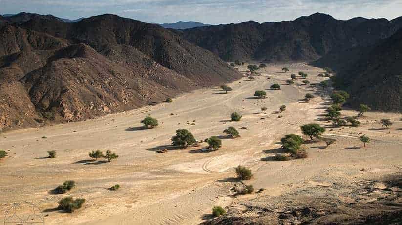
Wadi El Hitan Fayoum is an Arabic name which equivalent to Whales Valley in English. In fact, Wadi El Hitan is a pale ontological site situated in Fayoum, Egypt. It is about 150 km southwest of Cairo. Wadi El Hitan Fayoum designated a UNESCO World Heritage Site in July 2005. The valley has hundreds of fossils of some of the earliest forms of whale and the archaeoceti. (a now extinct sub-order of whales). The site reveals evidence for the explanation of one of the greatest mysteries. In fact, it is about the whales evolution. The emergence of the whale as an ocean-going mammal from a previous life as a land-based animal.

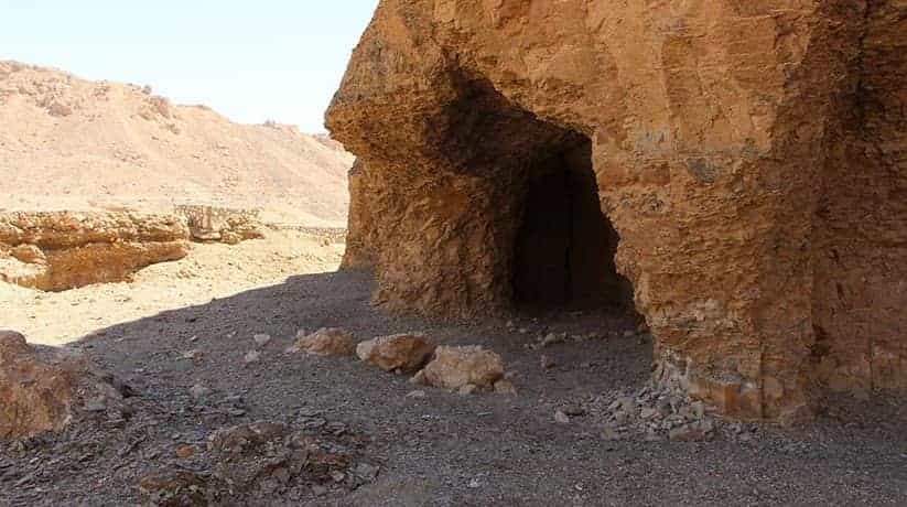
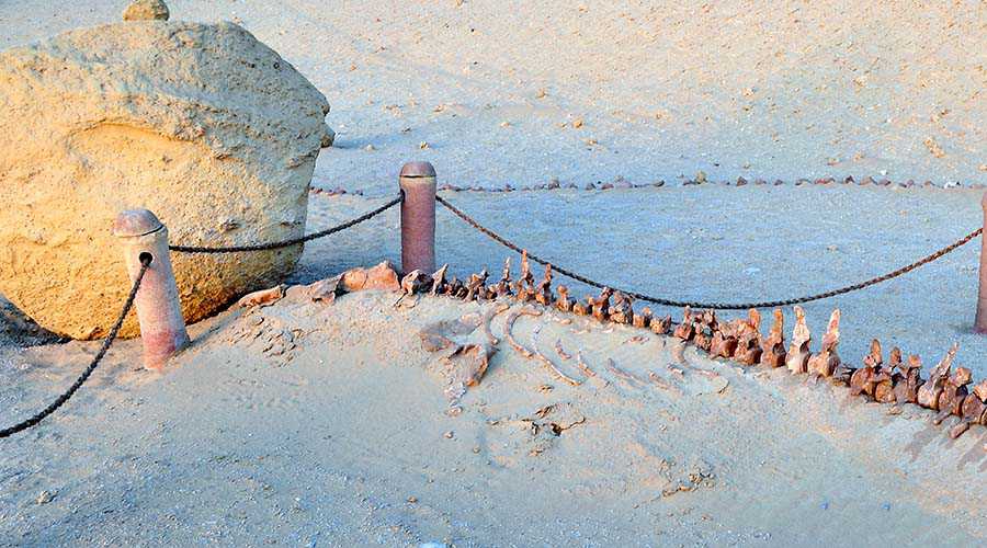
Wadi El Hitan has indeed hure number of fossils. In fact, they are accessible and sit in an attractive and protected landscape. That is why, Wadi El Hitan added by UNESCO to the list of protected World Heritage sites. In fact, the fossils which found at Wadi El Hitan Fayoum are not the. However, they feature great concentration in the area. Moreover, the degree of their preservation is really amazing. Some stomach contents indeed are intact. Moreover, the valley has fossils of other early animals such as sharks. Furthermore, the valley also has fossils of crocodiles, saw-fish, turtles and rays. The first fossil skeletons of whales discovered in the winter of 1902-3. For the next 80 years they attracted little interest. In fact, it was due to the difficulty of reaching the area.

Further details about Wadi El Hitan Fayoum:

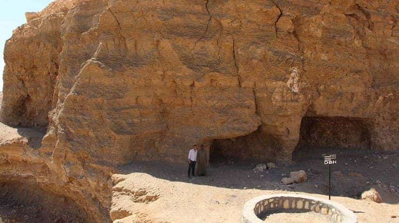
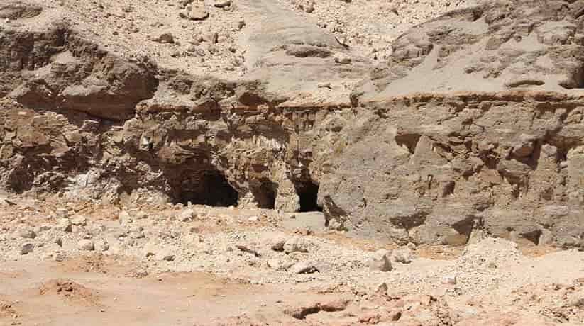
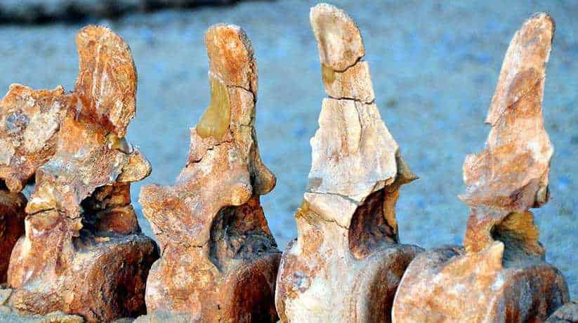
In the 1980 interest in the site resumed as four wheel drive vehicles became more available. The remains display the typical streamlined body form of modern whales. They retain some of the primitive aspects of skull and tooth structure. The largest skeleton which found, reached up to 21 m in length. It is with well-developed five-fingered flippers on the forelimbs. The unexpected presence of hind legs, feet, and toes not known. Their form was serpentine and they were carnivorous. A few of these skeletal remains exposed but most shallowly buried in sediments. And then, slowly uncovered by erosion. In fact, Wadi El Hitan Fayoum provides evidences of millions of years of coastal marine life. Fossils are present in high numbers and often show excellent quality of preservation.

The most conspicuous fossils are the skeletons and bones of whales and sea cows. In fact, there are also several hundred fossils of these have which documented. The fossils of whales vary from single bones to entire skeletons. Many of partial skeletons are currently on display in the public part of the park. The two common whales are the large Basilosaurus, and the smaller (3 to 5 meter) Dorudon. At least two other species known from rarer remains. The whales have small hind limbs which not seen in modern whales. Moreover, they also have a powerful skull with teeth. In fact, they are like those of carnivorous land mammals. Other mammals represented by the skeletons of three species of sirenia or sea cows. Bones of the primitive elephant Moeritherium also recorded in Wadi El Hitan Fayoum.

More details about Wadi El Hitan Fayoum:

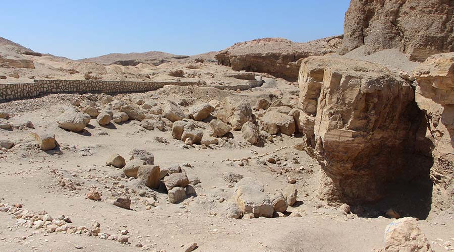
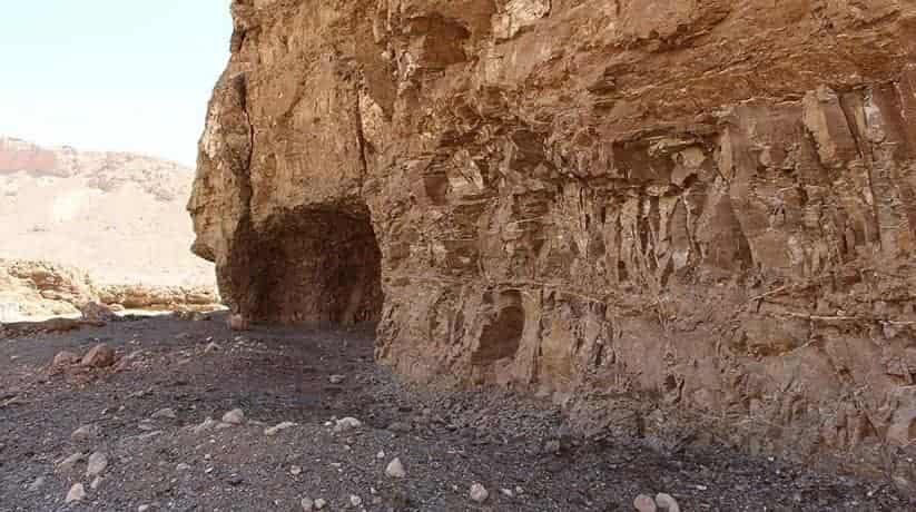
In fact, fossil reptiles represented by fossils of crocodiles and sea turtles. Furthermore, bones of sea snakes also recorded in Wadi El Hitan Fayoum. In fact, Wadi El Hitan Fayou has also many species of bony fish, sharks and rays. Larger fish fossils include the rostra and pegs of sawfish. A sawfish rostrum of 1.8 meters long laid out in the park. Fossil shells not common in the main whale-bearing rocks. In fact, they are common in other rocks. Moreover, many fallen rocks seen to be full of a wide variety of fossil shells. Disc-shaped nummulite fossils are common in places. A large log is also present in Wadi El Hitan park. In fact, the geology of Wadi El Hitan gives rise to the scenery. It is with wind and water erosion producing spectacular cliffs and buttes.

The rocks at Wadi El Hitan are all Middle to Late Eocene in age. Moreover, they comprise three main rock units. The Gehannam Formation comprises open marine mud stones. In fact, they are present on the flatter ground to the East of the public park. The rock unit which contains most of the whale fossils is the Birket Qarun Formation. This comprises yellowish open marine sandstone which form most of the cliffs and buttes. In fact, the monotony of these sandstone broken by a white layer. The layer full of well preserved animal burrows. A layer of black mud stone above that. When the cliffs of the Lake Qarun Formation followed to the East, they replaced by Gehannam. In fact, they replaced by mud stones formation indicating a change in water depth.

Further details about Wadi El Hitan Fayoum:

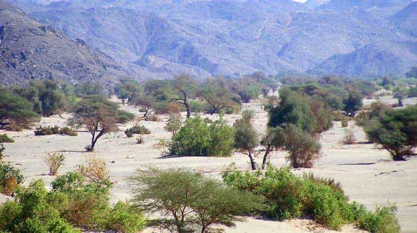
In fact, it was from shallower to deeper in that direction. The tops of the higher cliffs are within the Qasr El Sagha Formation. The formation comprises dark mud stones. It alternate with limestone full of shells and represents a lagoon environment. Wadi El Hitan is also the home to 15 species of desert plants and about 15 types of wild mammals. In fact, it include the north African jackal, red fox. and Egyptian mongoose. It also include African wildcat and Dorcas gazelle. Fennec foxes visit the camp site at night. Only about 1,000 visitors a year drive into Wadi El Hitan by 4WD. In fact, it is because the track unpaved.

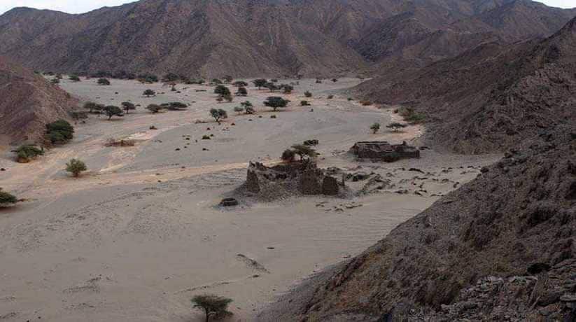
Most of visitors to Wadi El Hitan are foreigners who usually camp in the valley on winter weekends. Wadi El Hitan is within the Wadi El Rayan which is also a Protected Area in Egypt. The same protection management plan restricts visitors. In fact, they restricted to prearrange guided tours along a prescribed trail. Sustainable tourism is the beginning to develop and grow in the area. The 4WD replaced by foot or camel treks. A part of Wadi El Hitan made into a tourist venue. That is why, walkways between the main fossils laid out and small shelters built. This public park now visited by tourist groups and a small camp site is present.

More details about Wadi El Hitan Fayoum:

The valley located behind a mountain, known as Garet Gohannam. In fact, Gara means hill or mountain and Garet Gohannam means the mountain of hell. In the light of the setting sun, the mountain seems ablaze with an eerie red light. The Egyptian government alleged that a pair of cars driven by Belgian diplomats entered a protected zone in this area. In fact, they and caused 325,000 US dollars worth of damage. It was in July 2007. The Belgium government said no damage caused by its diplomats. In fact, this issue remains unresolved.
[/vc_column_text][/vc_column][/vc_row]

Nearby attractions Information, tours and Online Booking

More of Egypt Nature Exploration

More of Egypt attractions

MORE
Virgin Mary Tree Cairo

Virgin Mary Tree Cairo

  • Virgin Mary Tree Cairo
  • Virgin Mary Tree Cairo
  • Virgin Mary Tree Cairo
  • Virgin Mary Tree Cairo
  • Virgin Mary Tree Cairo
  • Virgin Mary Tree Cairo

Virgin Mary Tree Cairo Egypt tours, prices, booking, reviews

Virgin Mary tree Cairo is an old sycamore tree. It is under which the Virgin Mary used to rest. It was while taking refuge in the village of Matareyya during the Holy Family’s flight in Egypt. In fact, the original Virgin Mary tree Cairo which lasted till 1890 is now dead. Another tree grew by itself in the same place after that died. Moreover, the current green tree grew on its own and stands today. The tree attracts thousands of pilgrims each Christmas. It called Virgin’s tree. Matareyya is an incoherent district in Cairo, Egypt. There are many sacred trees in Egypt. Furthermore, these trees offered shelter for the Holy Family during their stay here. In fact, the tree holds the highest regard of all.

Matareyya now a heavily populated suburb in Cairo. It accessed by a modern fly-over. Two thousands years ago, it was a fertile and simple village. It was where many of these balsamic trees grown and many date palms too. In fact, the village of Matareyya was popular among pilgrims from the Holy Land. Moreover, at that time, it considered one of the holy sites and a blessed place like paradise. The journey of the Holy Family took them from Palestine to Egypt. The journey lasted for about three and a half years. It took them through many towns in Upper and Lower Egypt. The accounts of this journey chronicled in a Mimar (manuscript). It is by Pope Theophilus. He is the 23rd Patriarch of Alexandria (384-412 A.D.) He wrote down what the Virgin Mary told him when she appeared to him in a vision.

Further details about Virgin Mary tree Cairo:

In fact, the Holy Family journeyed south from Palestine across the wilderness. They avoided the main road for fear of capture. They entered Egypt at Rafah. It was where a lone sycamore tree said to have survived since their visit there too. In fact, Egypt is the only other country in which Jesus lived. It is besides his homeland Palestine. When the Holy family drew near to the city of Hermopolis (Cairo), they saw a tree. It was before the gate of the city. The travelers from afar were weary from their journey. They approached this tree to rest a while. The tree was tall but did not offer adequate shade. The Egyptians called this tree “Persea” and worshiped it as a god. They believed that some divinity hidden in the tree.

In reality, an evil spirit dwelt in this tree. As the holy family approached the tree, the tree shook fiercely. The evil spirit terrified by the approaching Christ-child and fled. Then Virgin Mary tree Cairo bent its top down to the ground. It worshiped its Creator like a rational creature. Thus the tree cast a great shadow, under which the weary travelers rested.

More details about Virgin Mary tree Cairo:

From that day, Virgin Mary tree Cairo received miraculous healing powers from Christ. It heals every infirmity of men. Afterward, the holy sojourners went to the village of Matareyya. Near the village they saw a fig tree. While Joseph went into the village on business, Virgin Mary took refuge under the fig tree with the Lord. The tree lowered its crown down to the ground to create a shadow for the travelers. Its lower half split open in such a way that the Mother with the Child could enter and rest. A living spring of water opened up near the fig tree.

Joseph found a hut in the vicinity, where they settled. There, they lived and drank water from that miraculous spring. This was the only spring of living water to found in Egypt. All the other water in Egypt comes from the Nile Rive.

Nearby attractions Information, tours and Online Booking

More of Coptic Egypt

More of Egypt attractions

MORE
Virgin Mary monastery Dronka

Virgin Mary monastery Dronka

  • Virgin Mary monastery Dronka
  • Virgin Mary monastery Dronka
  • Virgin Mary monastery Dronka
  • Virgin Mary monastery Dronka
  • Virgin Mary monastery Dronka
  • Virgin Mary monastery Dronka
  • Virgin Mary monastery Dronka

Virgin Mary monastery Dronka Asyut, Egypt tours, booking, prices

Virgin Mary Monastery Dronka located about 10 kilometers from Asyut, Egypt. In fact, the monastery lies on the west bank of the Nile. Moreover, the monastery indeed is one of the most famous Monasteries in Egypt. The monastery was one of the last destinations which visited by the Holy Family. In fact, it was during their journey through Egypt. Moreover, the Holy Family, Jesus, the Virgin Mary and Joseph visited Asyut. In fact, it was before leaving Egypt for Nazareth. Since that time, monks of the monastery believe that this area inhabited by Christians. Indeed, this area of Egypt populated by the Christians. The monastery features the cave Chapel of St. Mary. In fact, this chapel dates back to the first century.

Further details about the Virgin Mary Monastery Dronka:

Moreover, the place receives as many as one million visitors per year. Furthermore, it said that the Virgin Mary appears in a luminous form within the chapel from time to time. This monastery should not confused with the much larger Al Muharraq monastery. The last one located further south and its name means The Burnt Monastery. In fact, it believed the the Holy Family arrived Asyut on the month of August. As a result, the monastery becomes crowded by visitors in August month. In fact, the monastery has celebrations from August 7th until the 21st every year. Moreover, the Monastery conducts masses and baptisms daily. Furthermore, Virgin Mary monastery Dronka receives visitors from 6 AM until 6 PM. Visitors may overnight in the Monastery provided to arrange a prior consent.

Nearby attractions Information, tours and Online Booking

More of Coptic Egypt

More of Egypt’s attractions

MORE
Sphinx Sound Light Show

Sphinx Sound Light Show

  • Sphinx Sound Light Show
  • Sphinx Sound Light Show
  • Sphinx Sound Light Show
  • Sphinx Sound Light Show
  • Sphinx Sound Light Show
  • Sphinx Sound Light Show

Sphinx Sound Light Show Cairo Egypt tours, prices, booking

Sphinx Sound Light Show takes place on the Giza plateau, around 30 minutes from Cairo. The one hour show is by many languages. It begins with the illumination of the Sphinx. Great Sphinx narrates the history of the pyramids and their builders. Moreover, Sphinx Sound Light Show uses laser beams and light projections. Furthermore, it is on the walls of the Mummification Temple. It is also on desert sands, pyramid walls and the Sphinx itself. It really is a condensed story of Egypt which unfolds. The accompanying soundtrack complements the surroundings. The voice of the Sphinx is dramatic and mysterious!

Have you ever wondered how life was thousands of years ago?. This question and others similar thoughts inspired creators to get you for a short while to the past. It will be by introducing the sound and light show. It indeed is a magnificent show that brings to life the rule of ancient Egyptians. The artists created a show to present images of all historical eras. For an hour, you enjoy Sphinx Sound Light Show near the Pyramids and the Sphinx. The history is re told by the Sphinx, telling you the most ancient secrets of the world. In the 21st century, you go back in time thousands of years ago to see how they built and survived!. The show manages to convey the great humane spirit and creativity behind their creation.

Further details about Sphinx Sound Light Show:

In fact, there you will find the pyramid of Khufu, the Immortal and Sky Grabber. They are close to its some alters. It is where the wood made boats of Khufu placed. And which King Khufu would use to sail on his journey to immortality. Moreover, you will also find the pyramid built by Khufu’s son Khafre. He made his own smaller and shorter than his father’s pyramid. In fact, you can see Khafre’s face, engraved on a sheet of green diorite stone. So lively as if the artist just finished it. Then, last but not least the pyramid of Menkaure. He was like his father. In fact, he was modest and decent enough to make his pyramid smaller than the other two. Sphinx Sound Light Show narrate the history of those great kings. It also does for their secrets, legends and secrets of ancient history.

For more information & Show Schedule, please visit the Official website.

Tel: (+202)33857320 – (+202)33847823 – (+202)33867374
info@soundandlight.com.eg
sales@soundandlight.com.eg

Nearby attractions Information, tours and Online Booking

More of Ancient Egypt

More of Egypt attractions

MORE
error: Copyright © www.etltravel.com !