Activities in Egypt Diving

Things to Do

Shag Rock Egypt

Shag Rock Egypt

  • Shag Rock Egypt
  • Shag Rock Egypt
  • Shag Rock Egypt
  • Shag Rock Egypt
  • Shag Rock Egypt
  • Shag Rock Egypt
  • Shag Rock Egypt

Shag Rock Egypt information, tours, prices and online booking

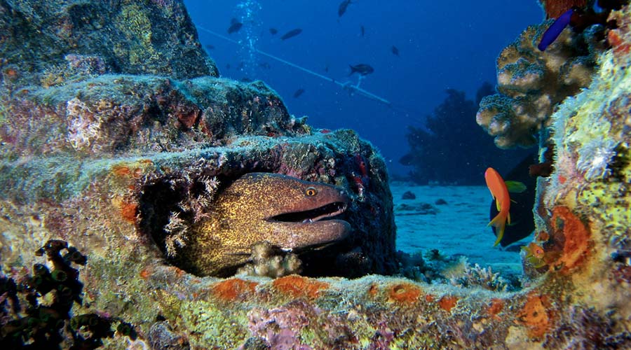
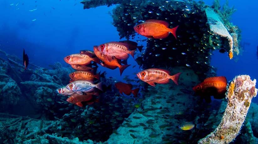
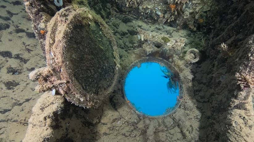
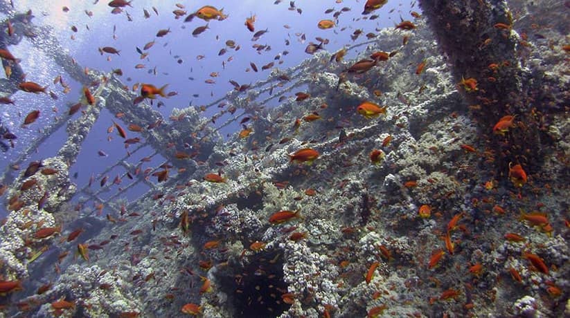
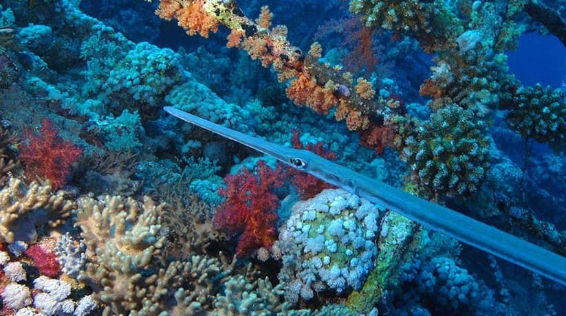
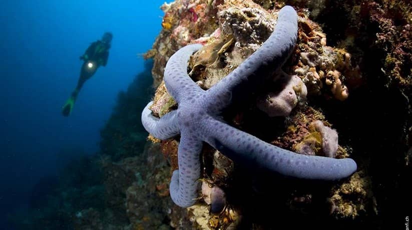
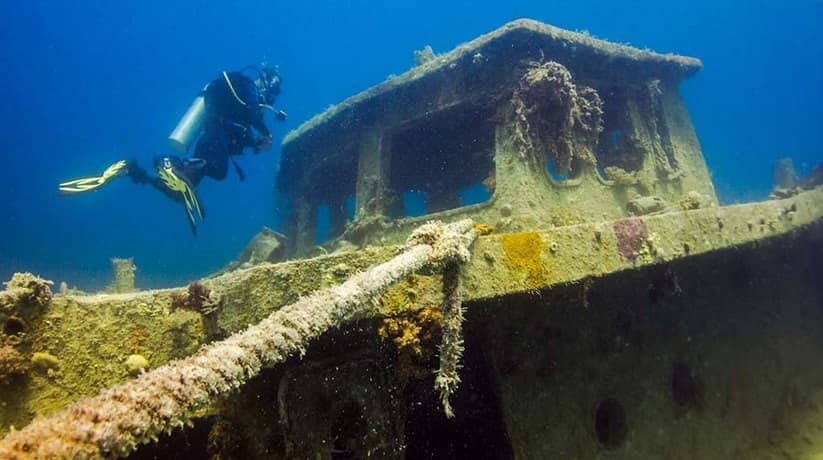
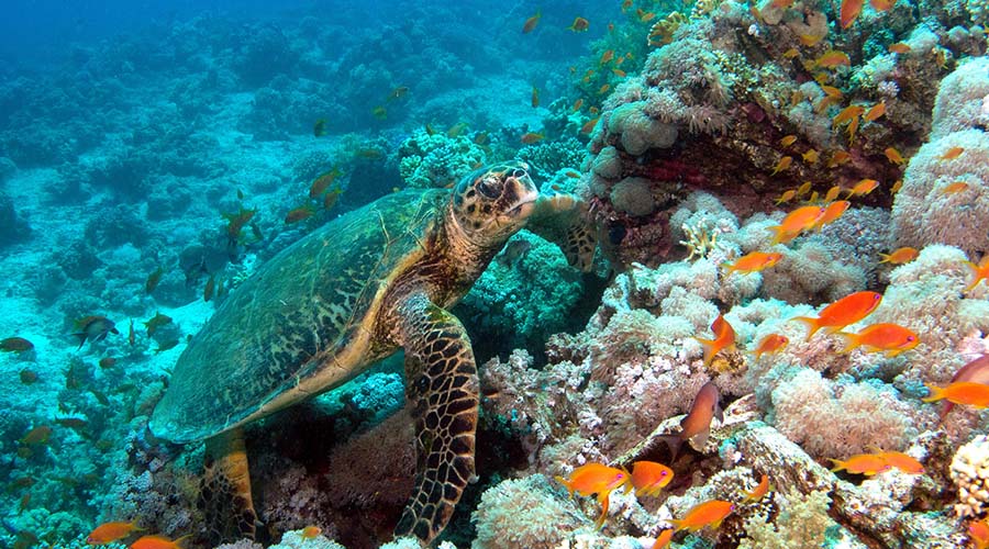
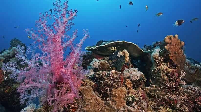
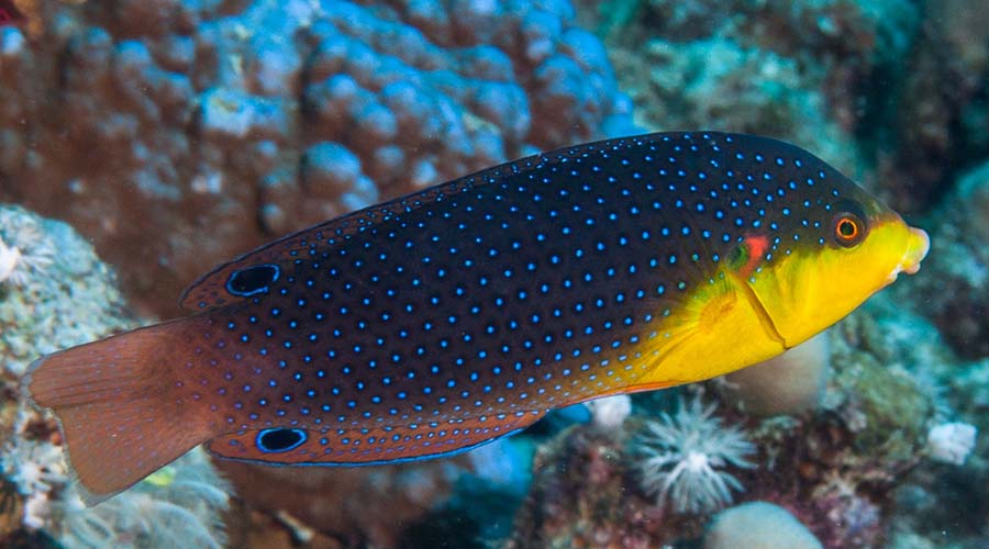
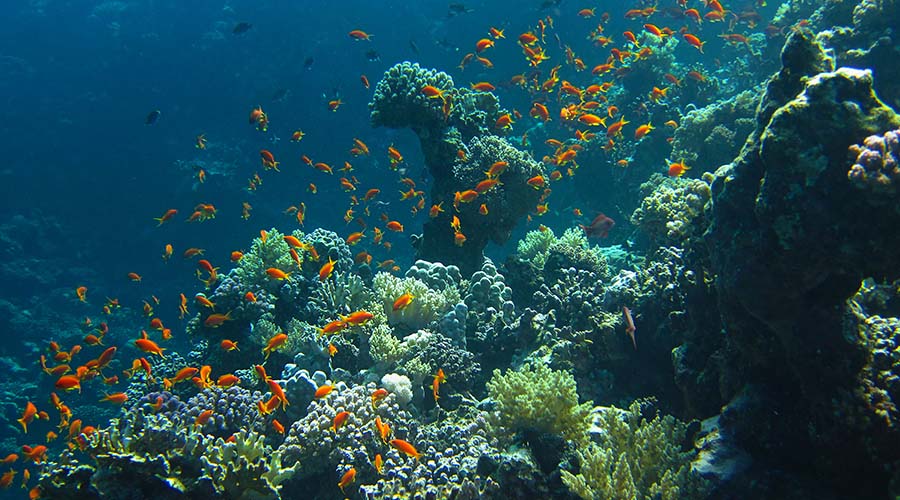
Shag Rock Egypt located in Sharm El Sheikh on the Egyptian Red Sea coast. In fact, refers to two reefs located on the south-western side of the Sinai Peninsula tip. It can accessed by boat from Sharm but it is usually listed on most of the live-aboard and diving safari tours in the Red Sea. The site holds its name after the numerous shags, or cormorants which were frequent visitors of the reefs. Divers usually prefer to dive the southern reef along its east side; additionally to housing amazing hard and soft coral formations, the site is also full of pelagic. There are also sea cucumbers, sweetlips and butterfly fish. In the northern part of Shag Rock lies the 18th century steamship boat Carina. In the eastern part of Shag Rock Egypt, lies the Kingston Wreck, also called the Sarah H wreck.

More information about Shag Rock Egypt (Carina Wreck):

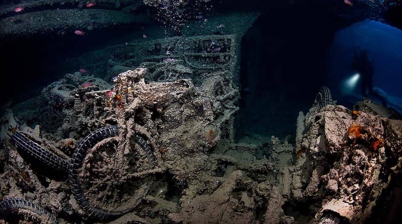
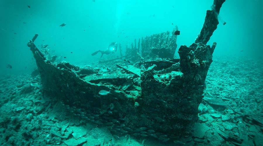
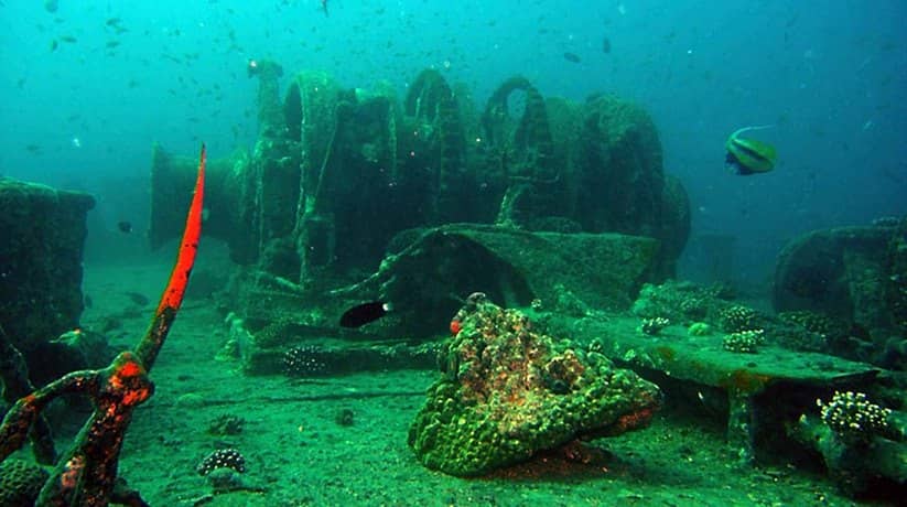
In fact, Carina Wreck lies on the northern side of Shag Rock. Carina was originally part of a large star constellation, Argo Navis. What is clear from the wreckage is that it was a large sail and steam ship from around the 1880 era. A large number of household bricks scattered amongst the wreckage refer that this was its cargo. The stern area still houses the propeller making it barely discernable from the rest of the wreckage. This site fed by strong currents and if they run, it is important that your dive guide drops you to the north of the wreckage. So, you at least get some time to drift over it before heading down the east side of the reef in a southerly direction. Normally the dive boats will drop you off and then go and moor further down around the east side of the reef.

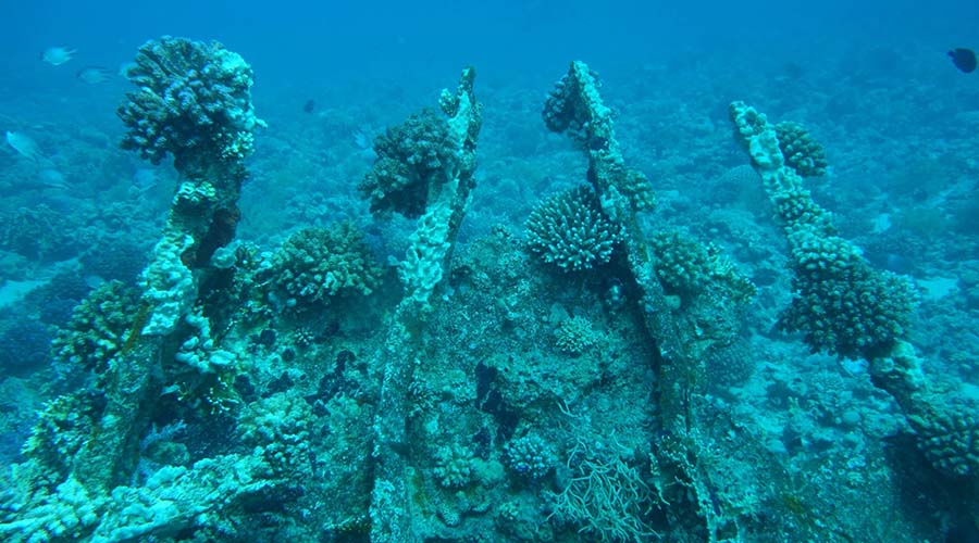
You make a “one way dive” back to your boat from your drop point. The current is running at around 2.5 knots past the wreckage. A steady knot or so down the east side make for an effortless cruise along the reef. This is a shallow dive with the majority of the wreckage in 10m or less. The edge of the reef at a similar depth of 12-14m. It makes for a good dive of the day or dusk dive. It will be before heading to Sha’ab Ali to moor for the night and get an early start on the SS Thistlegorm. You can also cross the Straights of Gubal back towards Hurghada. The corner of the reef where the wreckage lies slopes gently up. It is with table coral after table coral overlaid.

Further details about Carina Wreck:

In fact, it does have some of the best examples of hard coral in the area. The lack of a distinguishable break between sea floor and reef wall means it’s best to stick within visibility distance of the upwards sloping reef. In fact, it will be on your right shoulder, although if you do fancy some compass work, the coral garden to the east is lovely. If you get lost surface conditions are generally good for a boat pick up and other boat traffic is very minimal.

The site facts:

  • Dive Site Name: Carina
  • Location: Shag Rock Egypt, 27°47’45″N; 33°51’22″E
  • Description: 18th Century steamship
  • Length: 40 – 50 meters (130 – 165 feet)
  • Depth: 10 meters (30 feet)
  • Visibility: 30 meters (100 feet)

Further information about Shag Rock Egypt (Kingston Wreck):

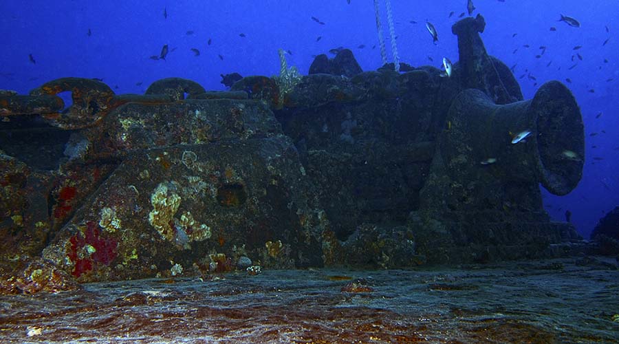
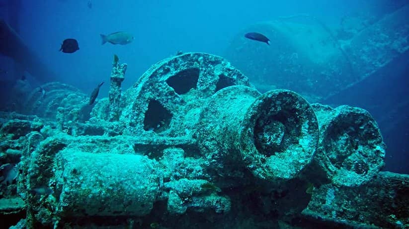
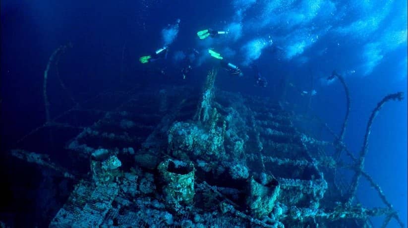
The wreck of the Kingston lies on the eastern side of Shag Rock. The Kingston is a very old wreck and built in the early 1870’s. You will often hear that it referred to as the Sara H, or Sarah H. This label actually came about in the absence of correct identification in the late 1980’s, early 1990’s. The Kingston is a twin mast steamship, 80 meters in length. Moreover, it is with a beam of 10m and it ran into the reef at Shag Rock on Feb 22nd 1881. Many of the wrecks in the Red Sea did not sink immediately. It took 2 days for it to finally accept its fate before it settled upright in only 18m of water (at the stern) on the gently sloping reef wall. The wreck is fairly intact, although its twin masts and funnel have long since gone.

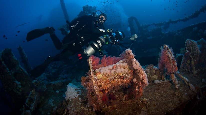
The prop makes for some great photographs with the sunlight penetrating the relatively shallow waters. Amidships there is a second prop which for some reason transported along with its cargo of coal. Despite its shallow location diving the Kingston can be challenging. Its position on the edge of the Gubal Straights means that the area can experience extremely strong currents. Dive boats will often moor around the southern side of Shag Rock Egypt after dropping divers to the north of the wreck. If the dive vessel has a tender (RIB), this can used to ferry divers to the wreck site. If the current runs it will normally be north to south. So, get your dive boat to drop you to the north of the actual wreck. And then, drift at a depth of about 15 meters onto the wreck.

More details about Kingston Wreck:

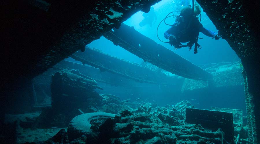
The belly of the wreck is very open and the wreck lies perpendicular to the normal currents. So, you can dive inside the wreck or along the starboard side. You can also seek effective protection from the current – allowing plenty of time to explore. Then simply drift of the wreck and head south (reef to left shoulder) along the coral encrusted gentle slope. The stony corals here are stunning with layer upon layer of acropora table corals covering the southeast corner. The Kingston is an ideal second or third dive of the day, after a visit to S.S Thistlegorm.

The site facts:

  • Dive Site Name: Kingston
  • Location: Shag Rock Egypt, 27°46’42″N; 33°52’36″E
  • Description: 18th Century steamship
  • Length: 80 meters (262 feet)
  • Depth: 20 meters maximum at the stern (65 feet)
  • Visibility: 20 – 30 meters (65 – 100 feet)

Nearby attractions Information, tours and Online Booking

More of Egypt Diving

More of Egypt attractions

MORE
SS Thistlegorm Sharm

SS Thistlegorm Egypt

.

  • SS Thistlegorm Sharm
  • SS Thistlegorm Sharm
  • SS Thistlegorm Sharm
  • SS Thistlegorm Sharm
  • SS Thistlegorm Sharm
  • SS Thistlegorm Sharm

SS Thistlegorm Sharm information, tours, prices and online booking

SS Thistlegorm Sharm built by Joseph Thompson & Sons of Sunderland and launched in June 1940. It was 126.5m in length and displaced 4,898 gross tones. Powered by a triple-expansion, 3 cylinder steam engine that generated a very comfortable 365 nominal horsepower. It was one of a number of “Thistle” ships owned and operated by the Albyn Line. Its construction being part funded by the British Government. However, it was destined for “War” duties from the moment it was launched.

Despite the manner of its sinking and the ongoing destruction, SS Thistlegorm Sharm is still in remarkable condition. The front section remains largely intact and sits upright on a sandy seabed at a maximum depth of 32 meters. The starboard anchor deployed and some railing are still in place. Moreover, all the winch houses, winches, blocks, windlasses and other paraphernalia are still there. On the main deck there is a railway water carrier on either side of No 1 Hold. It is with the one on the port side resting precariously over the edge of the Hold. Each hold built in two levels with the upper level known as “tween decks”. Basically, these tween decks are, in effect, a large shelf that stretched under the decks of the ship.

More information about SS Thistlegorm in Sharm:

There are Bedford trucks and a number of Motorcycles on the starboard side. Whilst the same found on the port side, the top of the hold bent downwards. It is with the presence of the water carrier, perched somewhat menacingly over the edge. It tends to be less well visited. Inside No 1 Hold, the cargo of parts and spares has come to look like an accumulation of debris. In fact, it obscures anything of greater interest – including more vehicles. Back at deck level, there is a Tender Railway on each side of No 2 Hold beside which are two “torpedo” shaped Paravanes. Once again there are some very interesting vehicles in the tween decks but below these on the port side. In fact, the diver will discover two large Armored Cars – built on Rolls Royce Chassis.

The starboard side of No 2 Hold, however, is where an incredible journey begins. Swimming gently above the vehicles, there is plenty of room to explore and inspect the various Lorries, Trailers, Motorcycles and other items as you journey below the bridge and pass through No 3 hold. Here are the small arms – weapons of various caliber in packs of 6 or 8 placed “Butt to Muzzle“. Each pack now concreted together as a single entity. Beyond this, is the fuel store – virtually empty after such a long journey. To one side, however, there is a large gap where the diver is able to exit through the bulkhead which once formed the bulkhead between No 3 and No 4 Hold.

Further information about the diving site:

Emerging into the daylight, the Diver is confronted by the devastation that surrounded the sinking. Ammunition boxes form a large pile of fairly uniform debris – on top of which is an up-turned tracked Bren Carrier. Pointing towards the stern is the broken drive shaft and some 20m further on is the remainder – sticking out of what remains of the stern. Below us, are a number of very large shells – possibly 14 inch, once destined for a British Capital Ship. The stern itself is canted over at an angle of 45 degrees and is as interesting as any other part of the ship. The two deck-mounted guns are still in place and are best viewed from below – where they make excellent silhouettes against the distant surface.

By now it is time to head back – swimming just above the wreck as we do so. Once again we pass over the most extensively damaged area before encountering that decking which was “peeled” back and now reaches almost to the Bridge. The evenly spaced steel girders which once supported the deck are now on top and who knows what lies trapped below. Off the port side, we see the remains of one of the two Railway Engines – remarkably, it is upright the seabed. Then we arrive at the Bridge and, although stripped bare long ago, still well worth a visit.

More details about SS Thistlegorm in Sharm:

A gentle current generally prevails from bow to stern. Large Grouper, Blacktip Sharks, Jacks and Tuna are amongst the largest fish encountered. It is with the latter two species providing an early morning display of speed and agility as they attack shoals of smaller fish at breakfast time. All the common Reef Fishes are also present.

The shipwreck facts:

  • Dive Site: SS Thistlegorm.
  • Description: Container ship.
  • Length: 126 meters (413 feet).
  • Depth: 16 – 33 meters (52 – 108 feet).
  • Visibility: 20 – 30 meters (65 – 100 feet).

Nearby attractions Information, tours and Online Booking

More of Egypt Diving

More of Egypt attractions

MORE
Barge at Bluff Point

Barge at Bluff Point

  • Barge at Bluff Point
  • Barge at Bluff Point
  • Barge at Bluff Point
  • Barge at Bluff Point
  • Barge at Bluff Point
  • Barge at Bluff Point

Barge at bluff point Egypt information, tours, prices and online booking

Known simply as the Barge at Bluff point, this is what remains of a ship with an identity that is lost. There are several theories about its origin, but none are confirmed. The wreck has sustained quite a bit of damage but it makes an awesome night dive. It is located on the East of the Big Gubal Island, which is a wonderful dive sight in its own right, just 10 minutes away. The Barge is covered in hard and soft corals and is home to breathtaking marine life. This includes several giant morays, nudibranchs, and large numbers of lionfish.

Bluff Point itself is interesting as a wall dive. You will see hoards of glassfish as well as octopi, squid, crocodile fish, scorpion fish, and butterfly fish. Turtles have also been known to make an appearance. In addition the wreck of the Ulysses is in the vicinity, but you will have to traverse strong currents to reach it. The Bluff Point location is good for several dives, where you can enjoy wrecks, amazing corals, and a variety of Red Sea life. It is easily reached from both Sharm El Sheikh and Hurghada.

Bluff Point:

Bluff Point, at the northeast end of Gubal Seghira island, extends like a pointing finger into the Straits of Gubal. The dive is along the island’s east coast, near the light which warns shipping off the sheer bluffs or cliffs. The reef here is a steep wall, following a meandering path along the coast. It boasts some very sheer, cliff-like sections, and is peppered with caves and cavelets. Coral growth is very good, with a wide variety of hard and soft corals on the reef face. A particularly attraction is the abundant growth of anti patharian black coral bushes at depth. A large cave lies just off the lighthouse and south of here, the reef bends inwards, eventually reaching the wreck of a barge.

This is the usual pickup point for dive boats. The section of reef between cave and barge often experiences tricky currents, so stay in close to the reef. A second wreck, carrying a cargo of electrical goods, lies several hundred meters to the north of the lighthouse, well covered in corals. Coral growth along the entire reef is good, with nice patches of dendronephthia soft corals and a wide range of stony species on display. Fish and other marine animals abound here. The site is famous for turtles, while bottlenose dolphins are also frequent visitors. The site offers the usual broad range of colorful reef species and there are lots of jacks and fussily.

The diving site facts:

  • Location: About 14km (9 miles) southwest of Shag Rock, in the Straits of Gubal.
  • Access: By day or live-aboard boat from Sharm El Sheikh or Hurghada.
  • Average Depth: 20m (65ft).
  • Maximum Depth: 30m+ (100ft+).
  • Average Visibility: 20m (65ft).

Nearby attractions Information, tours and Online Booking

More of Egypt Diving

More of Egypt attractions

MORE
Rosalie Moller Wreck Hurghada

Rosalie Moller Wreck

  • Rosalie Moller Wreck Hurghada
  • Rosalie Moller Wreck Hurghada
  • Rosalie Moller Wreck Hurghada
  • Rosalie Moller Wreck Hurghada
  • Rosalie Moller Wreck Hurghada
  • Rosalie Moller Wreck Hurghada

Rosalie Moller Wreck information, tours, prices and online booking

Rosalie Moller wreck Hurghada indeed is one of the most interesting ship wrecks to explore in the Red Sea. It is undeniably the 108 m long. In fact, the coal ship bombed by the German air force in October 1941. The ship in fact was transporting coal to Alexandria. The wreck is surprisingly intact today, with some areas covered with hard and soft corals. In fact, it lies at a depth of 39 to 50 meters. The ship’s mast can be spotted from as low as 17 meters. Only experienced divers allowed to make that dive. The visibility can be low and the currents are very strong in that particular area. In fact, a technical diving equipment needed. The site can accessed by boat from Hurghada’s port, or by live-aboard Safaris.

The Rosalie Moller stands as a proud example of British engineering from the early 20th Century. It is upright on the seabed on an even keel. The first thing we saw as we approached the wreck was the forward mast, with the mast-head lamp in place at 17m. Below this, the Bows are at 39m and the starboard anchor is deployed with the chain running down to the seabed at 50m and then out of sight. The port anchor remains fully retracted. The railings are largely still in place as is much of the accommodation, winch houses, blocks, winches, hawsers and other paraphernalia.

More information about Rosalie Moller Wreck Hurghada:

Aft of the Bridge, the funnel is still standing – with only the slightest list to port. On the leading edge is a small ladder up to a magnificent copper steam-whistle. Beyond this, the rear mast is also intact, the lifeboats davits are swung out and at 35m at the stern, the steering gear is available for inspection. Below this, the rudder is at 45m and hard over to starboard. Curiously, one of the four propeller blades is missing. There is external damage to both rear quarters, being slightly more extensive to starboard. Incredibly, the damage that caused the ship to sink is hardly noticeable and none of the cargo of coal appears to have spilled out.

The vessel is not on any of the regular diving routes and, unfortunately, does not enjoy the high levels of underwater visibility one expects from the Red Sea, 15-20m being normal. That said, corals are growing on the decks and the fish life can only be described as prolific. First thing in the morning Jacks and Tuna are seen feeding on the large shoals that congregate here and in the evening only the largest Grouper are found.

Nearby attractions Information, tours and Online Booking

More of Egypt Diving

More of Egypt attractions

MORE
Numidia Wreck Hurghada

Numidia Wreck Egypt

  • Numidia Wreck Hurghada
  • Numidia Wreck Hurghada
  • Numidia Wreck Hurghada
  • Numidia Wreck Hurghada
  • Numidia Wreck Hurghada
  • Numidia Wreck Hurghada
  • Numidia Wreck Hurghada

Numidia Wreck Hurghada information, tours, prices and online booking

Numidia Wreck located in the Big Brothers Island in Hurghada, Egypt. In fact, Numidia shipwreck found off the northern-most tip of the island. Quite often, however, there is a strong current running straight onto the wreck. This is a dive to set the heart racing and one of the most incredible shipwrecks available to divers. Like the Ada, it also defies all the known laws of gravity. In fact, it lies “up” the reef at an almost vertical angle. After nearly 100 years underwater it is, of course, now an integral part of the reef itself and will never move. At a depth of only 8m the diver will find the Bows well broken. Moreover, they marked by a pair of Railway Engine Wheels originally carried as deck cargo.

From here, the Numidia wreck quickly takes on its original shape and the diver is soon descending to deck level. The first thing that most divers comment on, however, is the absolute color that now adorns this vessel. Hard Corals and Soft Corals colonized this ship in a manner similar to the Ada – making them amongst the most beautiful shipwrecks in the world. The railings, masts, lifeboat davits, windlasses and deck winches are all still in place – having become part of a living Reef of such vibrancy that it is easy to lose sight of the fact that this is a “wreck diving!”.

More information about Numidia Wreck Hurghada:

In amongst the varied colors – from the lightest greens to the deepest reds, is a fish life which made this shipwreck “home.” The groupers are probably the most outstanding inhabitants – but all divers have their own favorites and each is found right here. As for the ship itself, it is able to provide every type of dive for every type of diver. Even those who abhor wrecks will like this one. The wooden decking, of course, gone and, of course, the cargo salvaged. This, however, provides an incredible opportunity to investigate a large ship at whatever depth suits the personal requirement. Forward of the central bridge are two cavernous cargo holds with ventilation hatches along the starboard side. The decks are now a square pattern of steel in between which is the lower half of the forward mast.

Immediately behind No 2 Hold is the raised central “castle”. In fact, it is with its accommodation and what remains of the Bridge. Constructed of wood on a steel floor, all but the basic outer framework has rotted away. We are now at a depth of 50m and the remainder of the ship lies in very deep water. Immediately behind the bridge is the ships funnel which fallen over to one side. Moreover, here several lifeboat davits swung out. In fact, the Engine Room is immediately below. Moreover, the decking is very similar in appearance to which nearer the Bows. Once again, the diver will find the lower half of an equally stout rear mast – also defying gravity. In fact, it is along with all the attendant deck winches.

Further information about Numidia Wreck Hurghada:

The stern raised and provides a beautifully rounded poop deck below which the single large propeller is found at a depth of some 80m. Apart from the damage encountered at the Bows, all metal structures are fully intact. It is throughout the ship. Moreover,  they all covered in the most exciting arrangements of hard and soft corals. In fact, they only begin to fade in their intensity from 50m downwards. The largest Grouper are also a feature of these deeper aspects of the Numidia wreck Hurghada.

Nearby attractions Information, tours and Online Booking

More of Egypt Diving

More of Egypt attractions

MORE
Excalibur Shipwreck Hurghada

Excalibur Shipwreck Egypt

Excalibur shipwreck Hurghada information, tours, prices and online booking

Excalibur shipwreck lies in fact a few meters from shore, inside Hurghada’s harbor. The wreckage of the Excalibur, also referred to as the Suzanna. In fact, the site is an easy dive for all levels of divers. It can even accessed from shore but boat trips are also organized to reach the site. The Excalibur ship is a 22-meter long twin mast motor. It sank in 1995 for undetermined reasons. In fact, a fire broke out in its main section a short time before it sank. Today, you’ll find it resting on the sea bed in an upright position.

More information about Excalibur shipwreck Hurghada:

Divers usually explore the inside of the ship – a torch will definitely come in handy – where sinks, toilets and electric gear testify of the diving ship’s past. Moreover some lovely fish species find the Suzanna pretty hospitable. This is the case of regular glassfish and lionfish. Small barracudas also visit from time to time, so do dolphins and turtles, but really rarely!

Excalibure Shipwreck site facts:

  • Depth: 22 meters.
  • Visibility: 10 – 30 meters.

Nearby attractions Information, tours and Online Booking

More of Egypt Diving

More of Egypt attractions

MORE
Ras Nasrani Sharm

Ras Nasrani Sharm

  • Ras Nasrani Sharm
  • Ras Nasrani Sharm
  • Ras Nasrani Sharm
  • Ras Nasrani Sharm
  • Ras Nasrani Sharm
  • Ras Nasrani Sharm

Ras Nasrani Sharm information, tours, prices and online booking

Ras Nasrani Sharm in fact known as the “Christian Cape”. In fact, the site is a shore diving site and one of the richest in Sharm El Sheikh from a marine life perspective. Due to the ever-changing underwater scenery, divers love this location. It is in fact very probable to spot mantas and whale sharks. Southwards from the usual boat mooring, you’ll find a wall. To the north, a gradually descending plateau and strong currents. In fact, they make this spot a perfect one for some drifting. Moreover, they also do it perfect for meeting with big pelagic coming to feed on the currents.

More information about Ras Nasrani Sharm:

Ras Nasrani Sharm plateau and wall covered with spectacular and healthy species of corals. It is where reef fish, giant moray eels and turtles come to hide and feed on the coral heads. In fact, the divers from all levels can dive this site. Moreover, there are some tricky hazards for the more experienced ones. It is such as caves and narrow passages, and amazing sights for the novices and the snorkelers.

The diving site facts:

  • Location: Western mainland point at the southern end of the Straits of Tiran.
  • Access: By shore, or by local or live-aboard boat from Sharm El Sheikh, Naama Bay or other ports.
  • Average Depth: 20m (65ft).
  • Maximum Depth: 40m+ (130ft+).
  • Average Visibility: 20m (65ft).

Nearby attractions Information, tours and Online Booking

More of Egypt Diving

More of Egypt attractions

MORE
Hebatallah Shipwreck Egypt

Hebatallah Shipwreck Egypt

Hebatallah Shipwreck Egypt information, tours, prices and online booking

Hebatallah Shipwreck is one of the most famous wreck diving sites in Hurghada. In fact, the ship was a small cargo ship of 494 GRT. It built for the Egyptian Government at Breheret Ets., Ingrandes, France in 1985. When launched, it was 44.5 meters in length and 8.5 meters in beam. In fact, it was with diesel engines and a single propeller for a speed of 8 knots. Hebatallah intentionally sunk on 07 November 2004 between the Giftun Island and Gota Abu Ramada. It was in the El Arouk Giftun area as Egypt’s first artificial reef. The idea behind the sinking was to relieve some of the pressure from dive tourism. In fact, it is on some of the other popular dive sites in the area. Hebataalla Shipwreck lies on the reef just outside of Hurghada’s main harbor for some years.

It was after having broken its moorings in heavy weather. Moreover, Hebatallah Shipwreck drifted onto the reef. Furthermore, it looked to be the perfect candidate for a new recreational wreck dive. The Red Sea Diving Association, with cooperation from the Egyptian Navy and the Red Sea Governor, purchased the ship from its owner. And then, the arrangements began for its sinking. This included removing all fuels, oils, and fluids from the ship’s machinery and tanks. Moreover, it also included the removal of all trash and loose equipment. Finally, they closed off areas where penetration prohibited and clearly marking exit points. Once all of this completed, the ship was ready for sinking.

More information about Hebatallah Shipwreck Hurghada:

Hebatallah ship originally sank in 30-meters of water. In fact, it was to provide access by divers of all certification levels. Yet, this was not to be. Unfortunately it sank in the wrong location and ended up resting in 46 meters of water instead, putting this wreck in the category of a shallow technical dive. Hebatallah Shipwreck lies upright on an even keel on a sandy bottom in 46 meters of water. The superstructure aft rises to a depth of 25 meters and its forward mast reaches up to 15 meters. In fact, the is a great dive for technical divers who are refreshing skills and testing new equipment.

Moreover, it is also great for these people who do not have the experience yet to go to deeper depths. The ship’s cargo hold lies between the superstructure and the forward mast is empty and open, and is easily accessed. The pilothouse is accessible as are two small spaces in the foc’sle. The ship, although a new wreck, already colonized by corals and the standard aquatic life in the area. In fact, there are some minimum requirements and restrictions on this wreck.

Hebatallah Shipwreck diving site regulations:

In fact, the divers must have a minimum of 100 logged dives and be certified as CMAS 3 star divers or equivalent e.g. Dive master with PADI, NAUI, SDI / BSAC sport diver / SSI dive control specialist. Moreover, only one dive per day allowed on the wreck. In fact,  diving the Hebatallah will inevitably require staged decompression. Furthermore, a maximum of three boats allowed to moor on the site at any one time. This is very important to adhere to ensure the sustained integrity of the wreck and for the enjoyment of the divers. Moreover, It strongly recommended that dive centers and dive guides do not allow full penetration of the Hebatallah Shipwreck. In fact, it is except for divers who certified to do so (such as full cave and advanced wreck qualifications).

Nearby attractions Information, tours and Online Booking

More of Egypt Diving

More of Egypt attractions

MORE
Shark and Yolanda Reefs

Shark and Yolanda Reefs

  • Shark and Yolanda Reefs
  • Shark and Yolanda Reefs
  • Shark and Yolanda Reefs
  • Shark and Yolanda Reefs
  • Shark and Yolanda Reefs
  • Shark and Yolanda Reefs

Shark and Yolanda Reefs Sharm information, tours, prices and online booking

Shark and Yolanda Reefs in Sharm are ones of the most famous of the northern Red Sea dive sites. That is why they always are very busy. The best time to dive this sites is at first light – somewhere around 6.30am. In fact, it is well worth the early start. The dive site is essentially a single pinnacle which rises almost vertically from around 800 meters. At around the 26m meter mark it splits into two separate pinnacles. The one to the east is known as Shark Reef and the one to the west is known as Yolanda or Jolanda. In fact, it named after the Cyprian freighter which hit the reef and deposited it’s cargo on the west side of it in 1980). The currents here can be strong and the best dive plan is for either your dive boat or its tender.

It is to drop you to the northeast of Shark Reef and then for you to descend and drift in onto the east side of Shark Reef. The boat drop should normally take place further away from the reef. It maybe advisable to take a compass reading and then drop below the surface to avoid the boat traffic. The water in Yolanda Reef is truly deep and as you look down the vertical wall the water takes on an inky dark feel. An ideal start depth here would be the 30-40m mark. It is where the current allows it is worth spending some time looking out into the blue. Whilst a little more rare these days it is still possible to see white-tip reef sharks. If you’re lucky larger, grey reef sharks identifiable by the thick black strip. In fact, it runs all the way down the rear of their tail fins.

More information about Shark and Yolanda Reefs Sharm:

Look out for barracuda, jacks and tuna. Yolanda Reef itself on the eastern side of Shark Reef fed by nutrients from the sometimes strong currents. As a result, there are some beautiful gorgonian fan corals and black whip coral. The deeper part of the reef has a proliferation of soft coral from the 30m – 70m range. Soft coral requires much less light than hard coral and seems to thrive in this inky abyss. Once you spent some time on the east side of Shark Reef, or if the current is running, then turn and with your right shoulder reef side head southwest around the reef. You will see the reef wall sloping up beneath you as you head towards the gap between Shark Reef and Yolanda and you drift over a rising plateau.

It is not the normal dive plan to go between two reef pinnacles. In fact, the current generally takes you past the two pinnacles on the south side. Yet, if current allows there are some beautiful hard coral formations between the two reefs. It is worth noting that coral growth is less around this object. You have to take care of the environment rather than gain a photographic trophy. As you come around to the west side of Yolanda Reef, there are vast numbers of toilets and sinks. They made up the majority of the cargo of the container ship Yolanda. A common misconception is that the cargo container wreckage is actually the wreck of the Yolanda- it is not. The wreck itself, having initially lodged precariously on the edge of the reef wall at around 25m, subsequently slipped over the edge, stern first, and down into the depths.

Further information about the site:

In fact, the wreck itself now rests on a 40 meter wide ledge. It is where it crumpled after its stern impacted with the ledge. The bow in fact is at 140m and the stern at just over 200m. The final part of the dive can either spent behind the north side of Yolanda or over the cargo wreckage. Normal exiting procedure is to ascend to your safety stop depth and drift away to the west of Yolanda Reef. If the current runs, perform your safety stops behind the reef. It is where you will get protection from the current before drifting off for pick up. Otherwise, you may drift far away from the reefs. Take extra care when exiting as there can be a lot of overhead boat traffic.

Shark and Yolanda Reefs diving site facts:

  • Dive Site: Shark Reef / Yolanda, Ras Muhammad.
  • Location: 27°43.150N; 34°15.590E.
  • Description: Reef / drift / wreck.
  • Depth: 36 meters (118 feet).
  • Visibility: 50 meters (165 feet).

Nearby attractions Information, tours and Online Booking

More of Egypt Diving

More of Egypt attractions

MORE
Omar Sukan El Quseir

Omar Sukan Egypt

  • Omar Sukan El Quseir
  • Omar Sukan El Quseir
  • Omar Sukan El Quseir
  • Omar Sukan El Quseir
  • Omar Sukan El Quseir
  • Omar Sukan El Quseir

Omar Sukan Egypt information, tours, prices and online booking

Exclusively accessible by boat, Omar Sukan is one of El Quseir’s most popular Diving sites. A usual dive starts by a downward drift to 30 meters. It is when the reef and its dramatically deep drop-off come into view. Come close to the wall and have a broad look around. You’re in for some stunning encounters with pelagic species. In fact, they rang from small sardines to bigger fish such as tuna.

More information about Omar Sukan Egypt:

By swimming over the end of the wall, while following the reef slope, you’ll find yourself in a flat coral garden. In fact, it stretches out to infinity. Unforgettable scenery that enchants all divers who had the chance and skills to visit this part of the Red Sea of Egypt. While drifting over the garden, look up to the reef top. It’s where Eagle Rays usually love to come and play, even with divers sometimes, whom they circle in a graceful ballet.

The diving site facts:

  • Dive Site: Omar Sukan.
  • Location: El Quseir, Egypt.
  • Depth: 12 – 40 meters.
  • Visibility: 30 – 60 meters.

Nearby attractions Information, tours and Online Booking

More of Egypt Diving

More of Egypt attractions

MORE
error: Copyright © www.etltravel.com !