

Ain Umm Dabadib Kharga Oasis information, tours, prices and online booking
The ruins at Ain Umm Dabadib (Ain Umm El Dabadib) in Kharga Oasis are actually very extensive. In fact, they located about 20 kilometers west of Qasr El Labekha. Moreover, they are about 40 kilometers north of Qasr Kharga. [expander_maker id=”1″ more=”Read more” less=”Read less”]This is a remote region of the oasis which lays on the Darb Ain Amur, the ancient route to the Dakhla Oasis. It is one of the more adventurous places to visit, absolutely requiring a guide just to find its location. The site is probably best known for its fortress which is situated in a most spectacular setting. It is nestled in at the base of an escarpment that is about 380 meters above sea level and 225 meters above the desert floor.
This was an important settlement for thousands of years. The ruins of Ain Umm Dabadib stretch over some 60,000 acres. It is where three major desert tracks converge on the plain. One track led from the fortress of El Leabekha past Ain Umm Dabadib and continued on westward towards Ain Amur and the Dakhla Oasis. Another cross the plain directly heading towards the Hibis Temple. It is while the third track crossed through Ain Umm Dabadib and headed northwestwards over the escarpment. In fact, it leads to a route connecting the Nile Valley with the Dakhla Oasis. It was probably the Romans who established a major settlement here. Though the complicated aqueduct system suggests that it was inhabited and functional long before them.
More information about Ain Umm Dabadib Kharga Oasis:
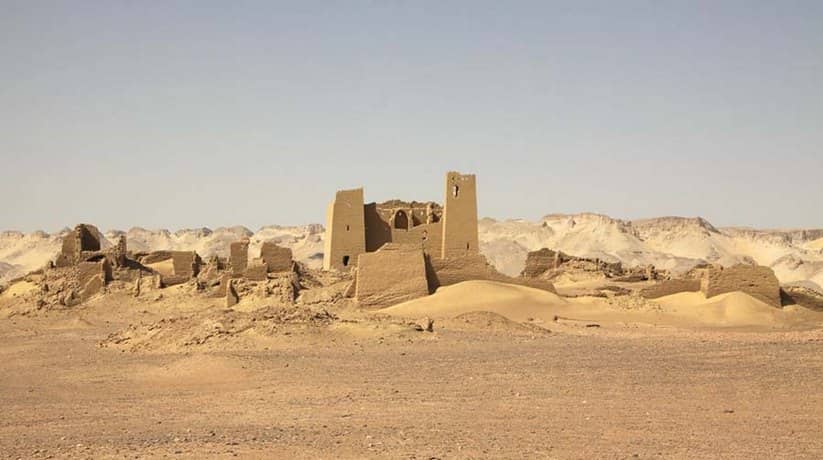
The towing fortress at Ain Umm Dabadib located about one half kilometers southeast of the ruins of the town. The enclosure wall surrounds an area of from 90 to 100 square meters. It is very unusual for its square towers, which flank the entrance on the south. However, like other fortresses in the Kharga Oasis, it made of mud brick. In fact, they are fairly uniform in size, measuring 35 by 17 by 9 centimeters. Some scholars believe that the fortress is of later date than those with rounded towers in the various oasis. It is because of its rectangular towers in fact. The tallest of the Dabadib towers, on the south-western corner, still contains the remains of a spiral staircase. Moreover, it rises to a current height of about 15 meters.
Smaller buildings crowded around its southern and western walls. While the interior of the fortress now ruined, several vaulted chambers at ground level are still intact. There are also the ruins of a Christian church, complete with several arches, which abuts the east side of the fortress. In fact, the aspe contained Greek, Coptic and Arabic graffiti. Regrettably, however, though the church was still mostly standing in 1997, it was only recently very damaged by an imbecile on a forklift seeking treasure. This is a problem that continues in some of these remote sites. The site may best known for its somewhat unusual fortress. But really the most spectacular ruins at Ain Umm Dabadib are the aqueducts.
Further information about Ain Umm Dabadib Kharga Oasis:
The Ain Umm Dabadib aqueducts explored by Ball in 1898 and Beadnell in 1898 and 1905. They also visited by Ahmed Fakhry in the 1930s. In 1905 Beadnell explored the a tunnel which cleared out by villagers from Kharga. He found that it still flowed with some thirty to thirty-five gallons per minute of water. In fact, the shaft that he explored measured 1.5 by .75 meters. Moreover, it cut through solid sandstone rock to a depth of 40 meters. Furthermore, it led to a tunnel measuring about 1.5 meters high by 60 centimeters wide at the top. In fact, it was halt and sultry. After a few attempts, Beadnell traced it to its end. He hopped to find an inscription that would date the construction and provide some clue to its builders. However, one should think twice about following his exploration.
He said: “On more than one occasion, I sank exhausted into the water, the huge gasps of breath. I took seeming powerless to relieve the horrible sensation of stifling. With the unpleasant prospect of getting drowned if I escaped suffocation. Yet there seemed to be ten thousand devils tempting me onwards. I did not know how long life could support under such conditions. A mad desire possessed me to see the thing through. So that whenever I was able to progress a few yards it was toward the head of the tunnel.”
More details about Ain Umm Dabadib Kharga Oasis:
These shafts are dangerous and appear to contain snakes, scorpions and bats. In the end, Beadnell found nothing in fact. Today, these aqueducts are still intact, snaking north from the town to the water source in the escarpment. They are by far the best example of such elaborate aqueducts in the Kharga Oasis. Along the route, every few meters, is an air vent and access hole. They permitted maintenance of the underground galleries. This was necessary because they were always filling with sand which had to be cleared out. Of course, a large settlement needed a constant water supply. During antiquity, an extensive 14.3 kilometers, twisting and turning underground system of galleries was created.
There are five main aqueducts that run parallel to each other. In fact, it is with main holes for maintenance along each of them. The longest of these is the westerly one stretching some 4.6 kilometers. The one to the north runs 2.9 kilometers and is 53.5 meters deep. Moreover, it has 150 shafts spaced about 19 to 20 meters apart. Furthermore, it descends about one meter for every 2.5 meters in length. Combined, the builders excavated some 4,875 cubic meters of earth, digging 600 to 700 vertical shafts. Moreover, they cut and moved over 20,000 meters of solid rock. This indeed was an amazing feat of construction. There, remain many questions about the aqueduct systems in the Western Desert. This one, due to its design and manner of construction, probably begun by the Persians. However, some scholars have suggested an even earlier date for some aqueducts.
Further details about Ain Umm Dabadib Kharga Oasis:
Ahmed Fakhry discovered in the Bahariya that the aqueduct was in place before a 26th Dynasty tomb was dug. Nevertheless, the Romans did extensive work on water systems in the Western Desert. Moreover, they constructed huge cisterns along the northern coast and underground galleries and aqueducts in most of the oasis. Yet, none of the Roman work really resembles, or is as sophisticated, what we find at Ain Umm Dabadib. Hey are closer in deign to the systems found in Libya and Algeria, as well as those in Iran (Persia) Afghanistan, Oman and China. Apparently, water is still available at Ain Umm Dabadib. From time to time over the years, farmers have attempted to clear the wells and re-cultivate the land. However, keeping the channels clear of sand seems to be very labor intensive. That is why these efforts so far failed.
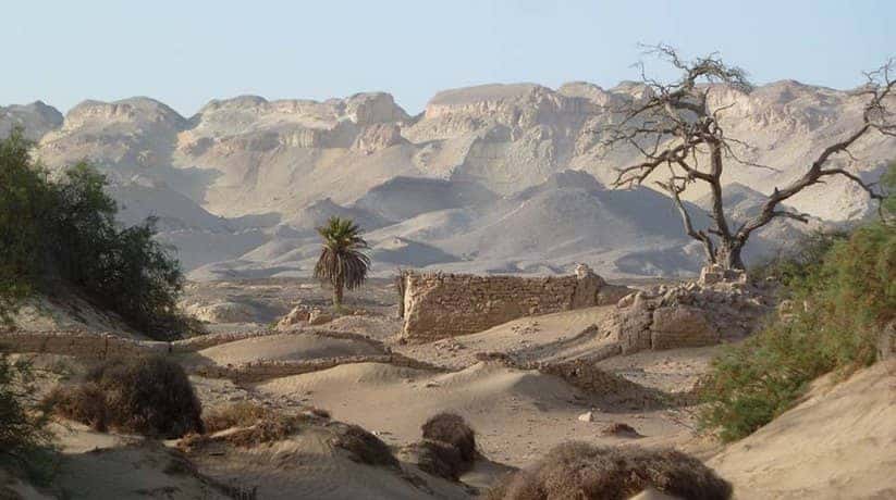
Lying to the west of the fortress are the substantial remains of a village bordered to its west by a number of Sunt trees. Another portion of the town, known as the Eastern Village, lies directly behind the fortress. Moreover, it contains a number of ruined mud brick buildings. The fortified town appears to consist of many luxurious houses. Sometimes up to three stories high, which currently studied by the team undertaking the north Kharga Oasis Survey. Recent discoveries in the area include a possible mill and s small hermitage. Reportedly, this area continues to be covered in potshards. Beyond the village is a very small temple. In fact, it easily recognized by its walls that slant inward from the base.
More information about Ain Umm Dabadib Kharga Oasis:
The temple has a pylon-shaped design at the front. Though within its vaulted ceilings are more typical of Roman-Byzantine architecture. In fact, the temple contains some hieroglyphs and scenes of Egyptian deities. Though there are also some Coptic inscriptions and traces of red paint. Just beside the temple is the second aqueduct. To the east of it, past some vegetation, is the third aqueduct sitting at the base of a spur of the escarpment. Ten different cemeteries identified at Ain Umm Dabadib by the NKOS team. It includes both rock-cut and shallow graves. Some of the tombs lined with mud bricks and some showed remains of mud brick facades. The variation in tombs, carved rock and painted prick suggest that all classes of society lived in proximity.
Some of these cemeteries appear to span as many as ten generations. To the east of the third aqueduct, all along the spur, are rock cut tombs. Some of them desecrated, with the remains of their mummies scattered about (though now this has been cleaned up). NKOS are currently studying the methods of mummification, but the mummies may be of Roman origin, NKOS researchers say. In fact, they still contain the brain. Moreover, the salt-dried bodies covered in oils and wrapped in pink, red, yellow and natural-colored linen bandages. Researchers also identified Roman mummy makes by their plaster curls and eyebrow fragments.
Further information about Ain Umm Dabadib Kharga Oasis:
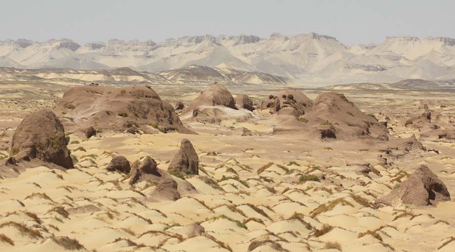
Unfortunately, Ain Um Dabadib historically failed to attract archaeologists. Though in 1998, excavations finally begun. There will be doubtless much that we will learn in fact. Prehistoric remains also located here. It is possible that the site occupied sporadically from these early times. Though its present importance is in providing valuable information. In fact, they covering the transitional period between Pagan and Christian Egypt. The area indeed is also very interesting Geologically. Dry river channels are evident as they fall from the escarpment onto the plain below. They lead one to suspect that waterfalls may have existed here in the distant past. The plain is actually a playa, a dried up lake
[/expander_maker]


