


Gilf El Kebir Egypt information, tours, prices, booking
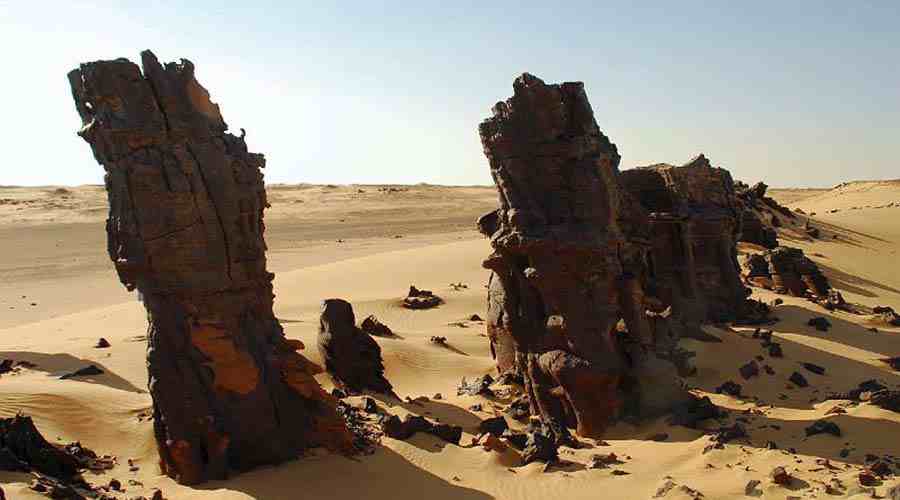
Gilf El Kebir located in the Western Desert in Egypt. In fact, the name means "Great Barrier". Gilf El Kebir located in the southwestern corner of Egypt about 720 km from the Nile. Moreover it is about 960 km from the Mediterranean Sea. In fact, it dissected in two by a large lid and rises 1075 meters above sea level. Gilf El Kebir indeed forms one of the most difficult barriers in Africa. The Western Desert indeed is full of amazing natural phenomena and surprises. If you walk around in the area or through a pass, you will discover indeed a strange worlds. In fact, the sides of Gilf El Kebir now eroded and penetrated by huge sand valleys.
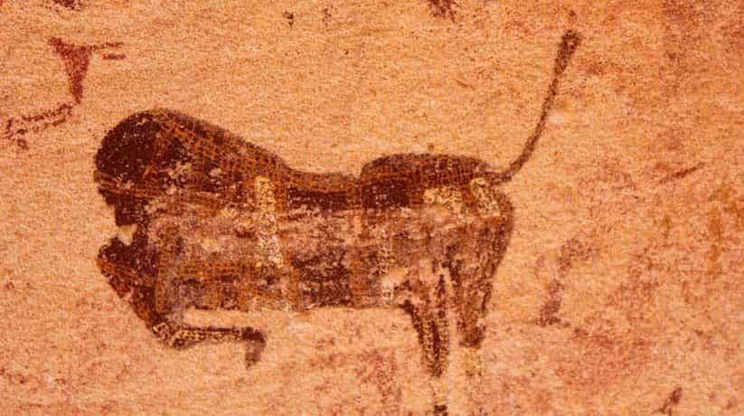
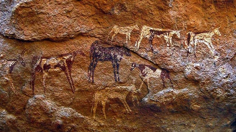
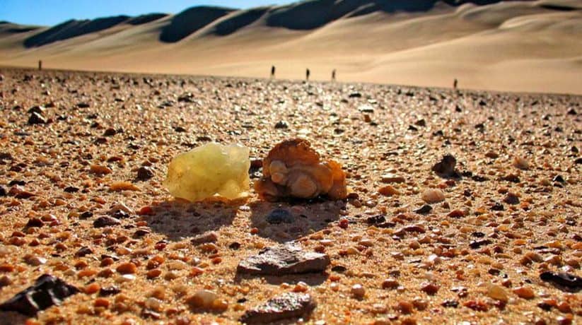
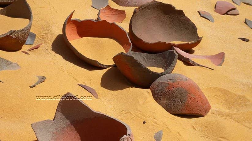
The plateau also has incredible sand dunes systems. This system, at some point, rise 300 meters to meet plateau level. Actually, the site has the most wonderful of natural settings. Undoubtedly, it is one of the richest stores of prehistoric rock art in the world. Gilf El Kebir houses the Swimmers cave which is the most famous in this plateau. In fact, some recent discoveries revealed many other incredible sites. These site that date back to more than 7,000 years. Moreover, there is much to explore in Gilf El Kebir. Furthermore, the area also houses El Mestikawy Cave. In fact, it is the best rock art site in the desert.
Further details about Gilf El Kebir Egypt:
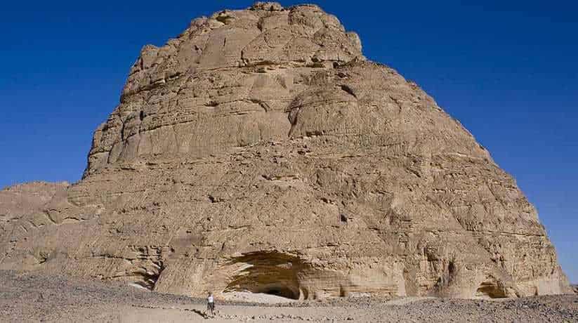
The cave discovered only in 2002. The indigenous people who invented these stunning images influenced early Pharaonic cultures. In fact, the cave proved this. Gilf El Kebir become a rather popular Egyptian tourist destination. It is specially for the most adventurous travelers. In fact, it is not only for the rock art, but also for the absolute grandeur of landscapes. It also shows how different Egyptian antiquity sites are. Moreover, Gilf El Kebir is large in a flat bottomed limestone plateau. It is about 150 km north of Gabal El Uweinat covering more than 7,770 square kilometers. Dozens of valleys extend to the desert around its surroundings.
These valleys formed by water erosion in a wet phase for thousands of years. In fact, it was in the late Triennial Age. Then there was a big gap, draining water in all directions, north, south, east and west. The slopes in the south and southwest of Gilf El Kebir are the highest. Moreover, the slopes in the northeast divided into small islands. Wind and water joined forces to work at the plateau for more than 100,000 years. The northern part of the large gulf drowns in the sand of the great sand sea. It helps the wind break the gulf into islands and small cones. In fact, this sand is white. Furthermore, the sand in the middle of the plateau is red. Wadi al-Hamra, as its name says, filled with red sand. The southern part of Gilf El Kebir is 5,800 square kilometers.
More details about Gilf El Kebir Egypt:
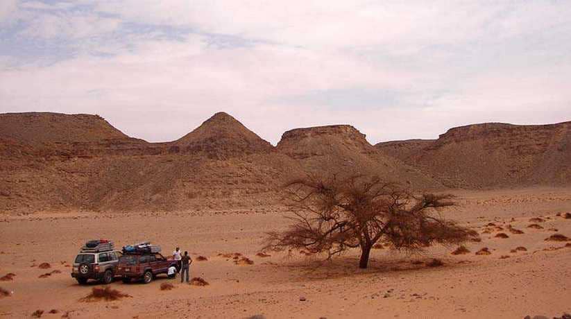
Around 9500 BC, the seasonal system shifted northward and lakes around the envelope. Then, by 4500 BC the conditions were again barren. The area has many vegetation-rich valleys such as Wadi Red, Wadi Tala and Wadi Abdul Malik. In fact, these valleys used by the tribesmen to graze. Moreover, some explorers believe it was the lost Zarzura oasis. During the Second World War, the Italians had a base in the region. It is while the British found El Uweinat. The British Army's long range desert group was active in the region.
A journey through the breathtaking landscape of Gilf Kebir indeed is a great adventure. Discovering this remote area of untouched nature is awe-inspiring. Indeed, it is one of the most exciting off-the-beaten-path touristic experiences in Egypt.
Weather:
The best time of the year to visit Gilf Kebir is in late autumn and early spring. In that time, you can take in the amazing prehistoric rock art in Gilf Kebir is . Beware of the scorching hot summer months and April month. In that time, the hot and dry winds (Khamseen) hit the region. Winter also unadvised – although the climate is pleasant during daytime. At night, temperatures can drop to as low as 0 C.
Where to stay:
Camping is the only accommodation option available in Gilf Kebir. Guides and our representatives will set the group camp in the middle of the dunes. They will also light a fire and ensure your security during your sleep.
Where to eat:
There are no restaurants in the barren region of Gilf Kebir. Basically, there’s one rule, what you bring is what you eat! But rest assured, we organizing trips to Gilf Kebir well prepared from that perspective. In fact, food and beverage always included in the safari package you’ll book.
The only way to get to Gilf Kebir is by booking a 4X4 trip with a guide. You don't want to get lost or stuck in the barren landscapes of the Western Desert. In fact, we will help you get the needed permits from the official authorities. A safari to Gilf Kebir can booked from Dakhla oasis (the closest oasis to this part of Egypt), or from Cairo.
A 4X4 is what you need to travel through Gilf Kebir. Usually, safaris organized in 4X4 convoys, equipped with GPS and satellite phone. A guide is of course a necessity.